Log in
All resources
Create a design
36,689 Free Images of 1838 Maps
maps made in the 17th century
gerard valck
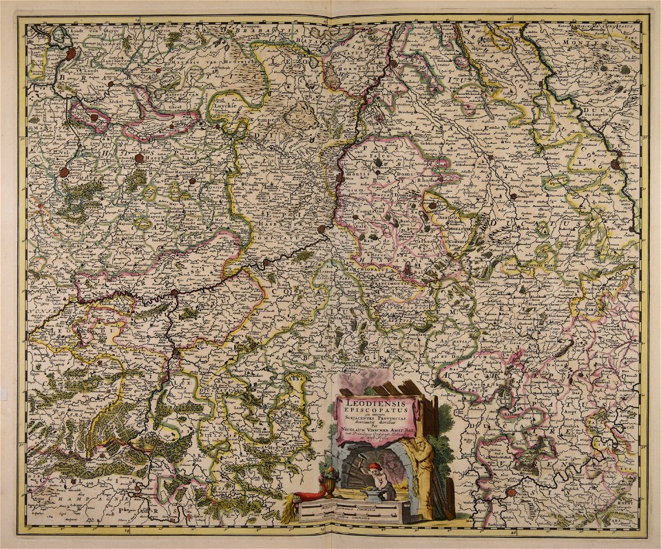
maps by pieter schenk (i)
atlantis magni tomus tertius (biblioteca comunale di trento)
atlantis magni tomus secundus (biblioteca comunale di trento)
maps in the library of congress
description of kingdom of georgia
its habits and canons
1740s maps of georgia
georgian-language maps
maps made in the 17th century
gerard valck
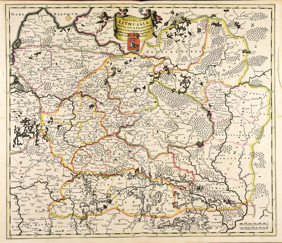
old maps of the grand duchy of lithuania
maps made in the 17th century
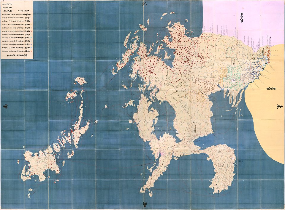
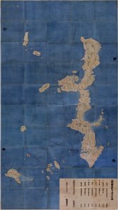
maps in the national archives of japan
hizen province
maps made in the 17th century
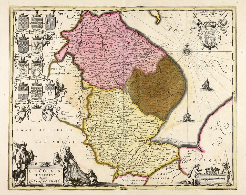
gerard valck
maps made in the 17th century
gerard valck
maps by pieter schenk (i)
gerard valck
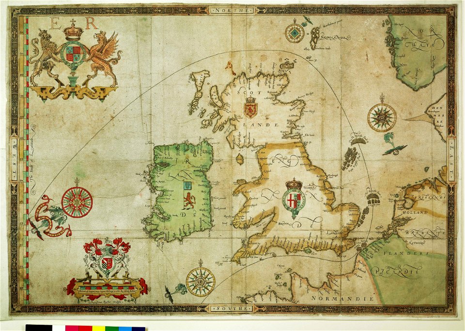
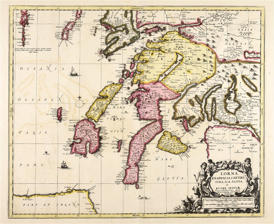
the track of the armada around britain and ireland
charts and maps of the royal museums greenwich
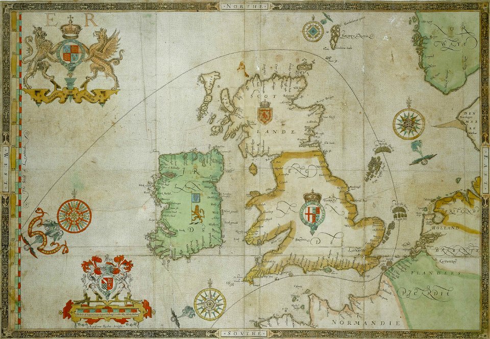
the track of the armada around britain and ireland
charts and maps of the royal museums greenwich
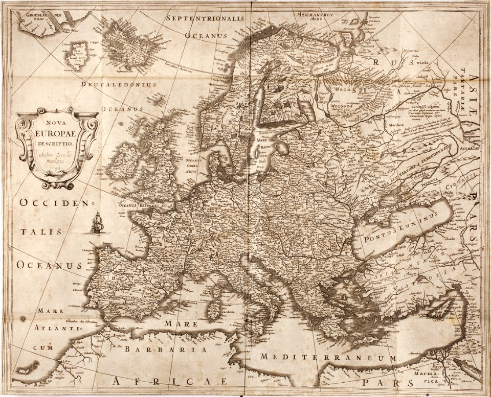
maps made in the 17th century
gerard valck
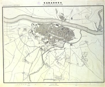
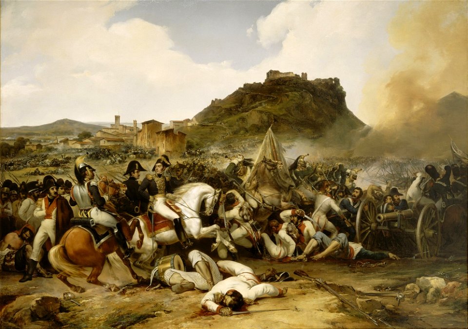
sitio de zaragoza (1808)
1868
17th-century engravings
faces of men in art
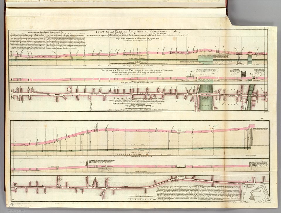
seine river in paris
old submaps of paris
maps from the mechanical curator collection
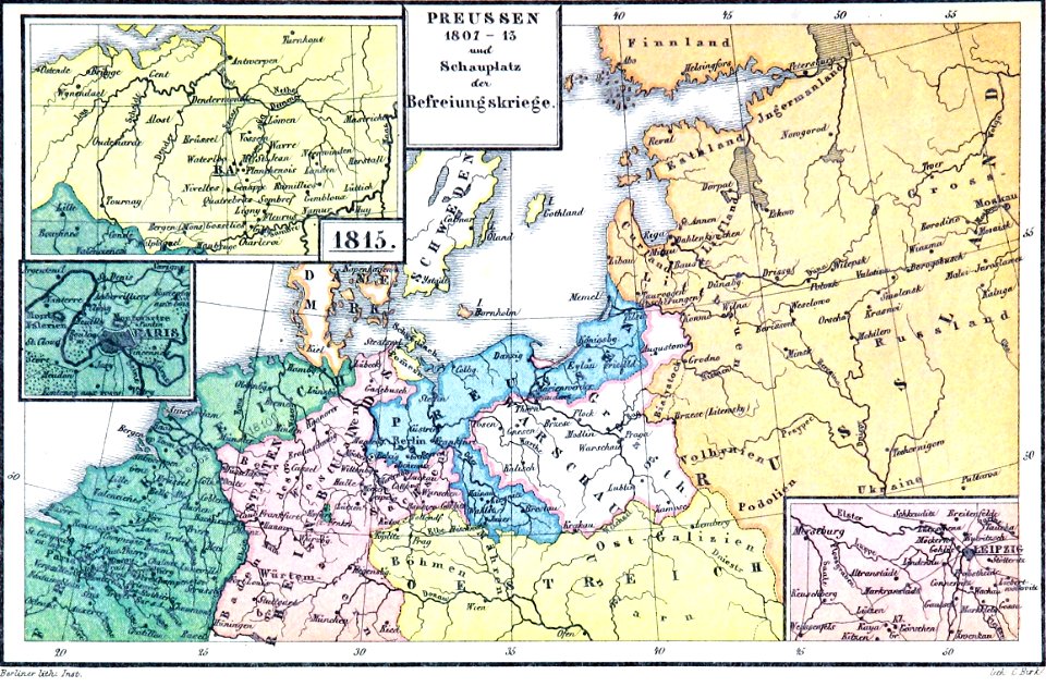
old maps of prussia
maps from the mechanical curator collection
old maps of prussia
old maps of the danube
french-language maps
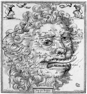
19th-century satirical maps
1899 maps of europe
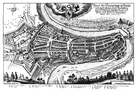
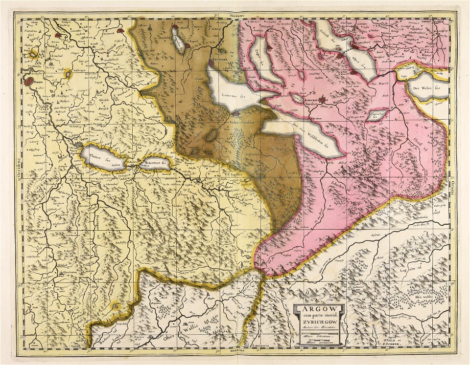
1638 in switzerland
bern
images from the new york public library
george hayward
19th-century paintings in the musée national du château de versailles
19th-century paintings of cavalry in battle
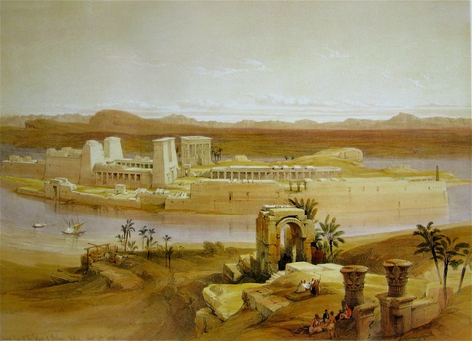
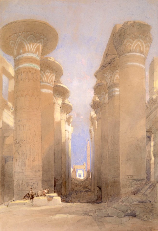
egypt
syria
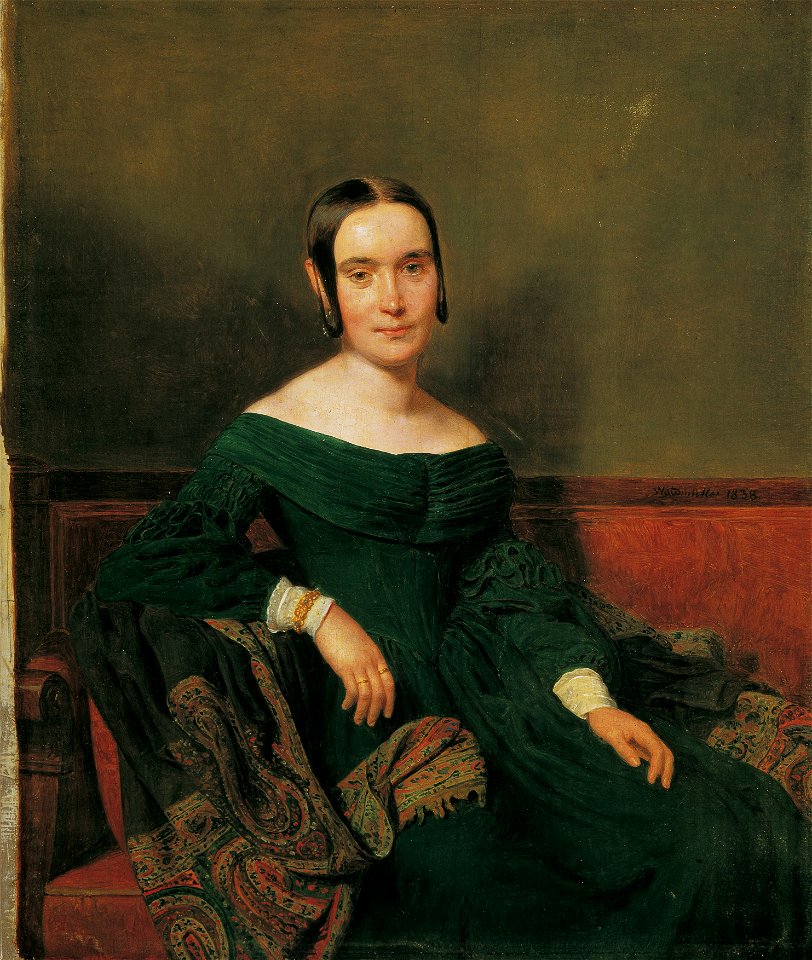
19th-century portrait paintings in the österreichische galerie belvedere
19th-century paintings of females with green dresses
egypt
syria
maps from the mechanical curator collection
old maps of prussia
cornell university library
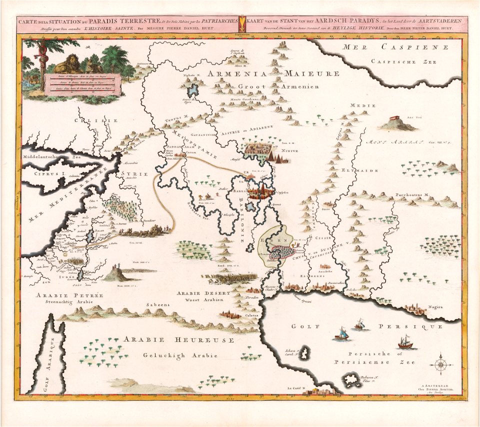
garden of eden
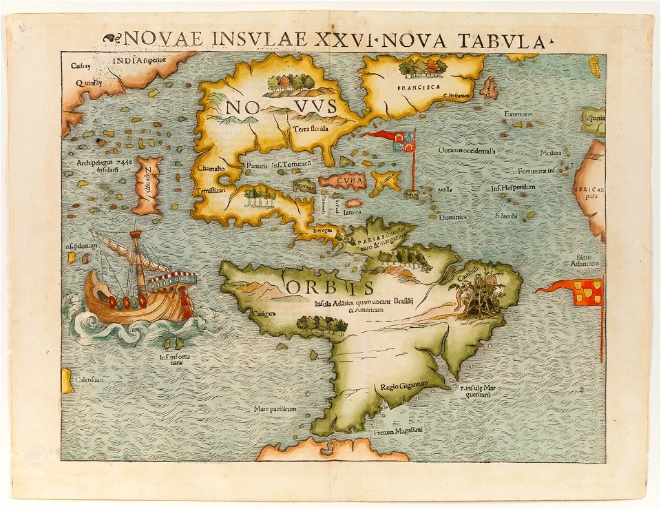
christopher columbus
ferdinand magellan
maps by willem and johannes blaeu
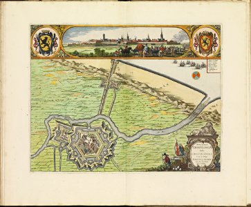
ravelins
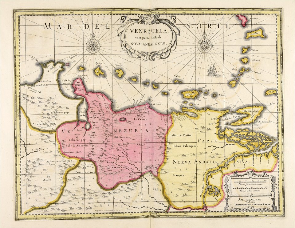
old maps of venezuela
gerard valck
maps made in the 17th century
gerard valck
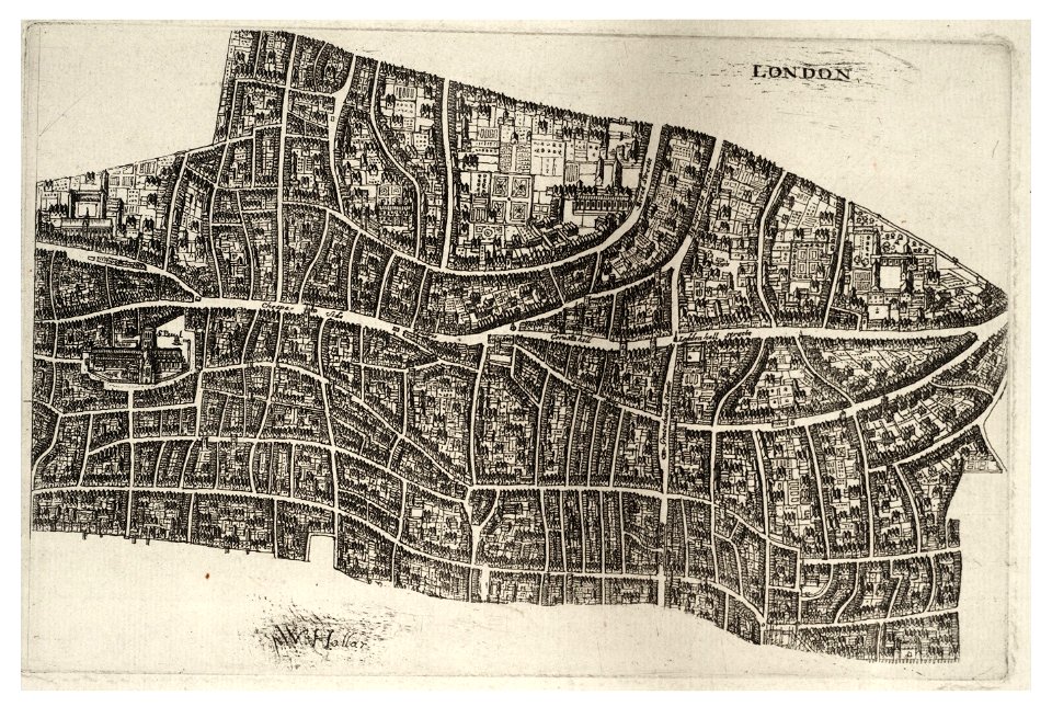
university of toronto wenceslas hollar digital collection
hollar maps and plans of london
university of toronto wenceslas hollar digital collection
hollar maps and plans of london
maps by willem and johannes blaeu
maps made in the 17th century
maps made in the 17th century
gerard valck
maps made in the 17th century
gerard valck
maps with cartouches
netherlands
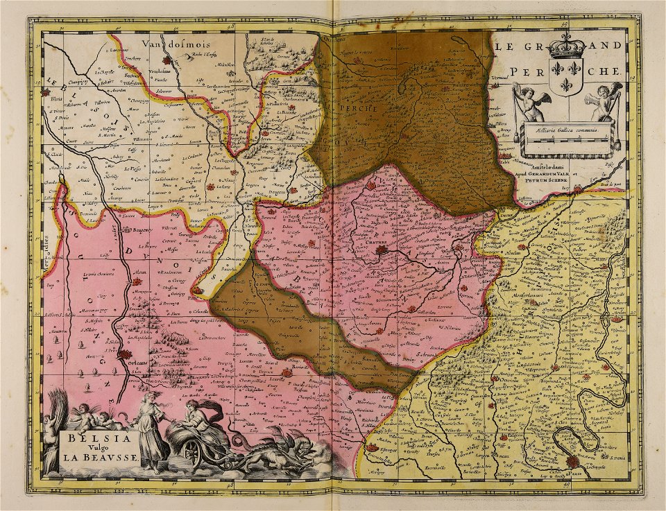
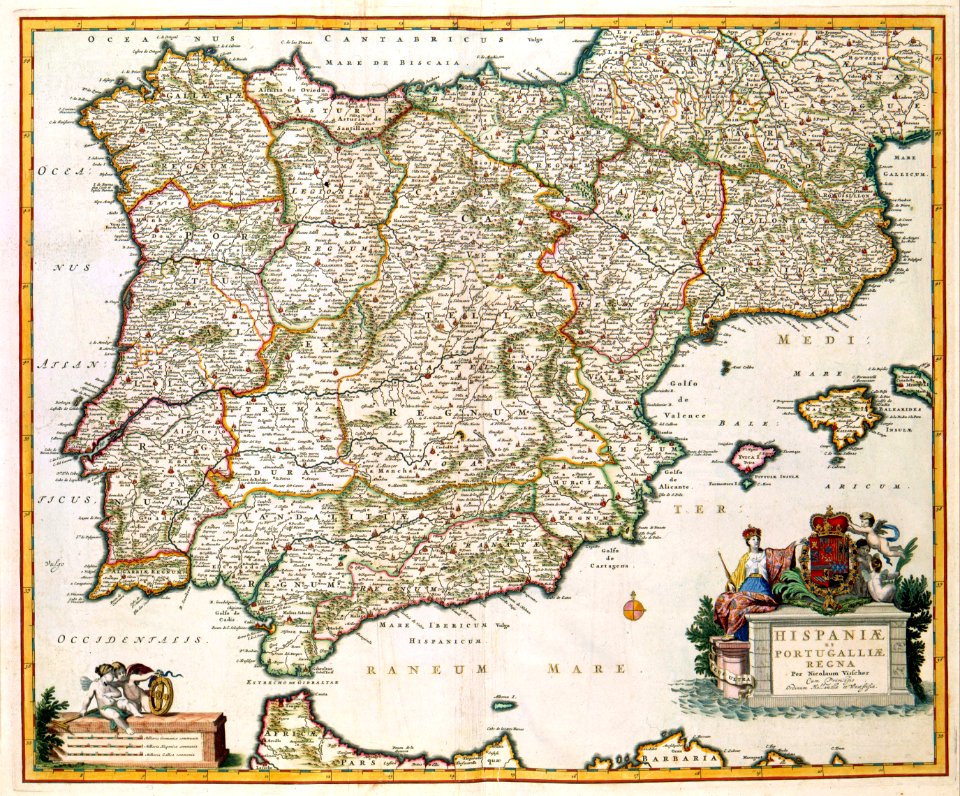
old maps of the iberian peninsula
nicolaes visscher ii
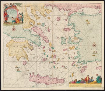
maps of the sea of marmara
old maps of the aegean sea
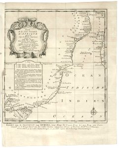
old maps of the dutch east india company - africa
1747)
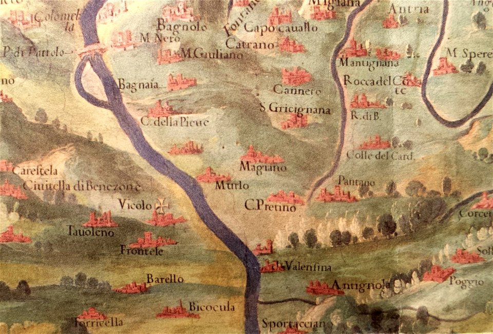
history of perugia
old maps of umbria
maps made in the 17th century
gerard valck
maps made in the 17th century
gerard valck
coats of arms of cities in corrèze
guillaume marie-anne brune
frédéric-auguste laguillermie
françois arago
maps in the national archives of japan
genroku kuniezu
frédéric-auguste laguillermie
coats of arms of orléans
maps made in the 17th century
gerard valck
prints from dankaerts historis at the peace palace library
cornelis danckerts (i)
maps made in the 17th century
gerard valck
maps made in the 17th century
gerard valck
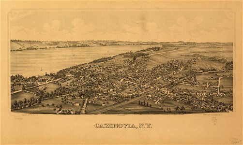
cazenovia
new york
maps made in the 17th century
gerard valck
maps made in the 17th century
maps by nicolaes visscher i
maps made in the 17th century
gerard valck
maps made in the 17th century
gerard valck
maps made in the 17th century
gerard valck
gerard valck
england
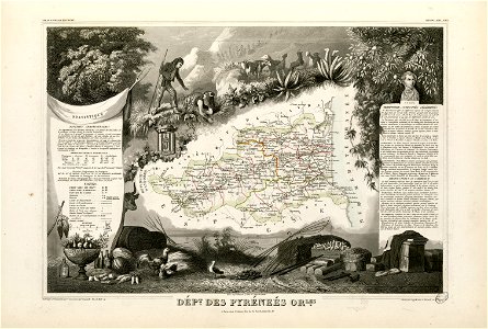
historical images of pyrenees
robert batty (artist)
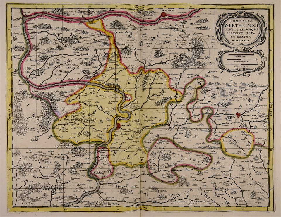
gerard valck
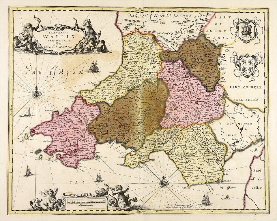
south wales
gerard valck
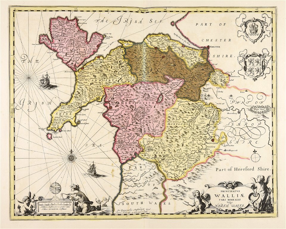
north wales
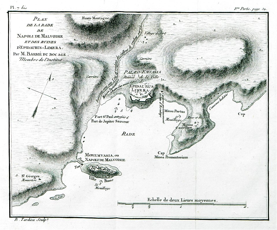
historical images of greece
1808 maps
maps by willem and johannes blaeu
maps made in the 17th century
maps made in the 17th century
gerard valck
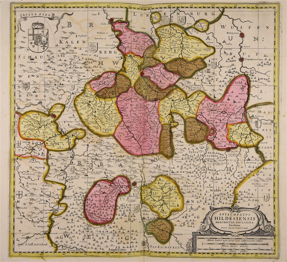
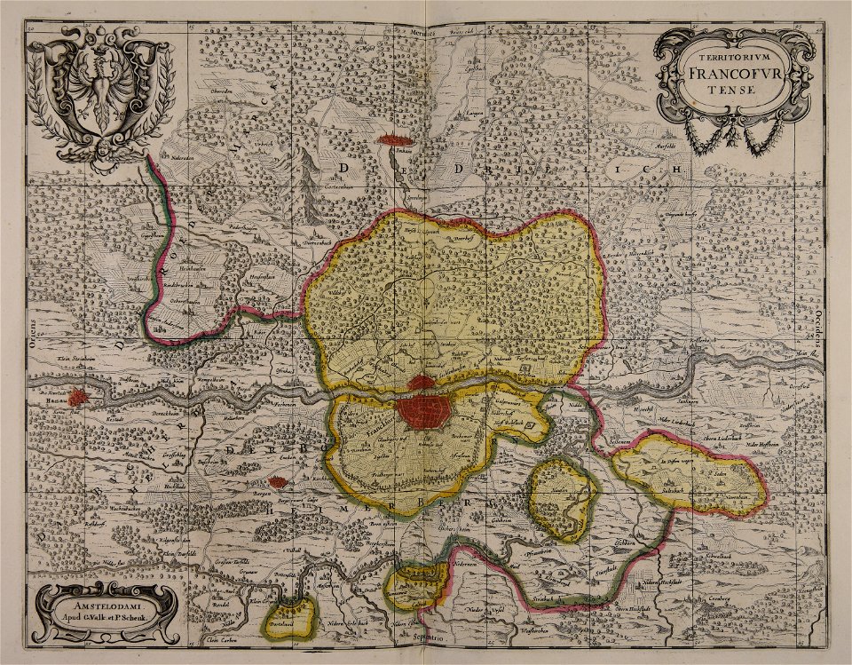
old maps of frankfurt am main
gerard valck
atlantis magni tomus secundus (biblioteca comunale di trento)
maps made in the 17th century
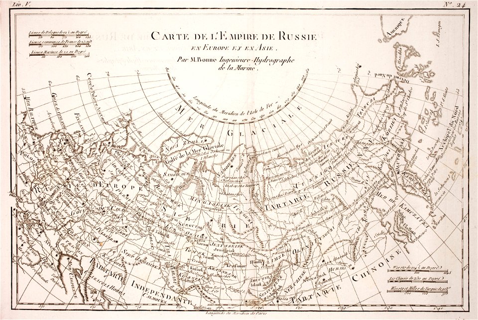
1780 maps of russia
bonne projection
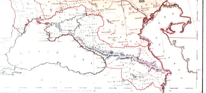
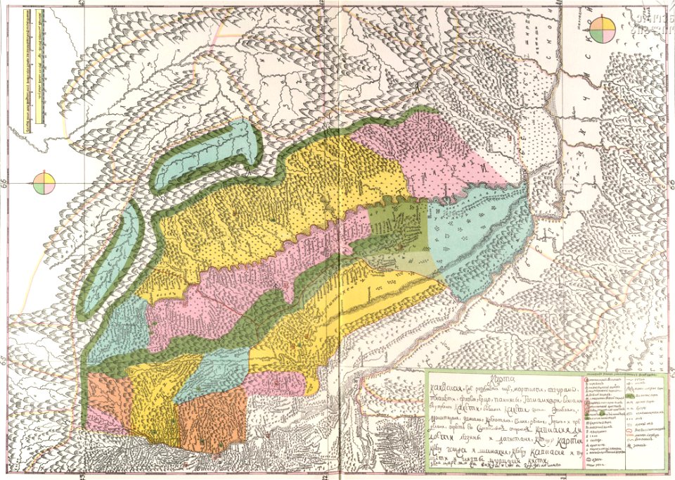
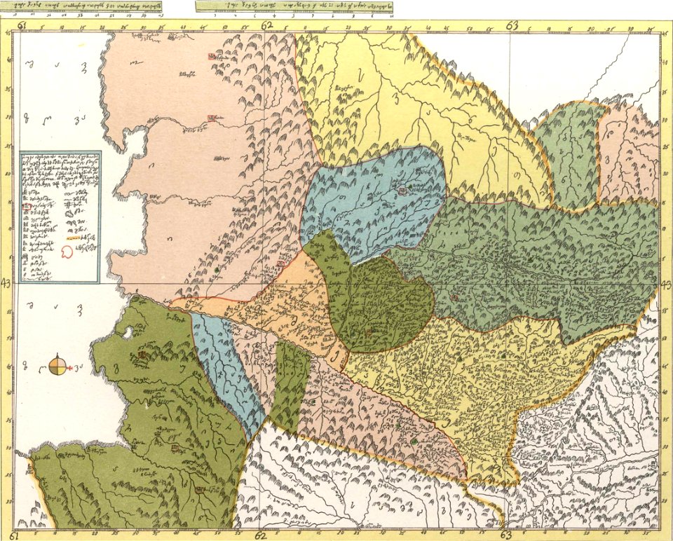
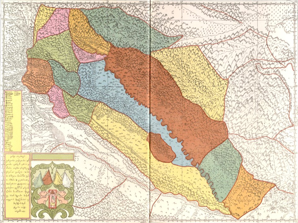
19th-century maps of the caucasus
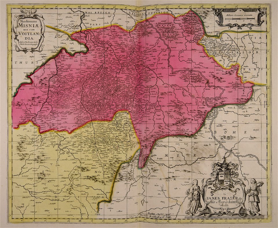
1856 maps
maps made in the 17th century
jan janssonius
description of kingdom of georgia
its habits and canons
maps in the stadsarchief amsterdam
hendrik de leth
description of kingdom of georgia
its habits and canons
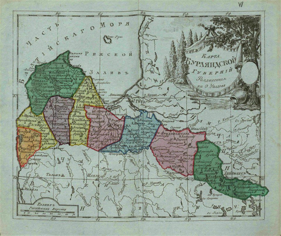
small atlas of the russian empire (1796)
old maps of courland governorate
description of kingdom of georgia
its habits and canons
description of kingdom of georgia
its habits and canons
description of kingdom of georgia
its habits and canons
description of kingdom of georgia
its habits and canons
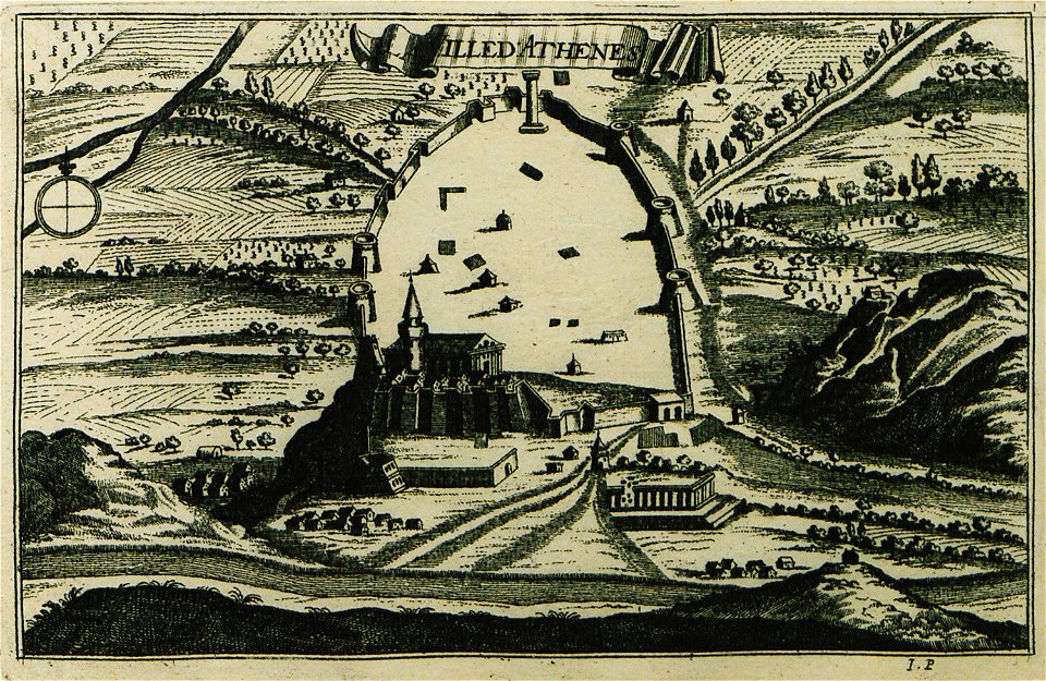
description des principales villes (1690)
old maps of athens
vatican gallery of maps
old maps of italy
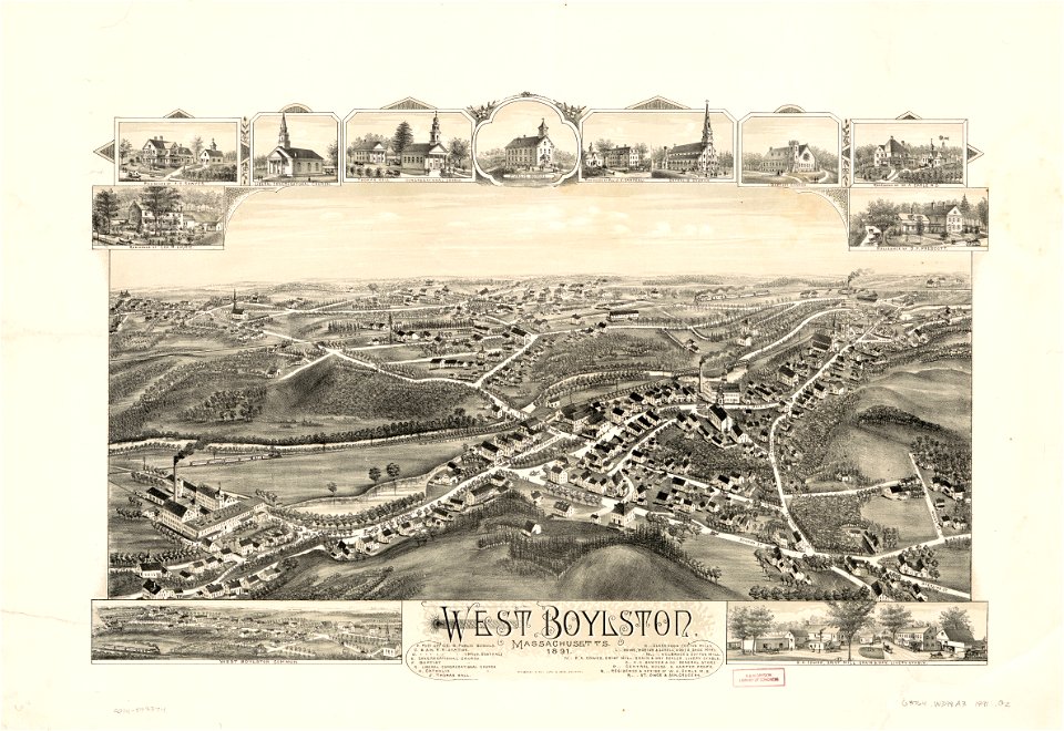
massachusetts
o. h. bailey
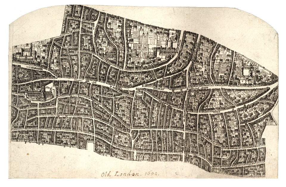
university of toronto wenceslas hollar digital collection
maps by wenzel hollar
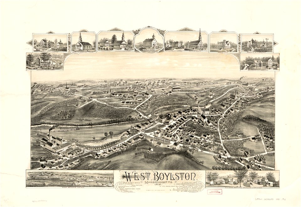
massachusetts
o. h. bailey
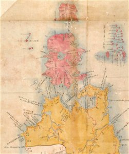
maps of the kuril islands
shōhō kuniezu
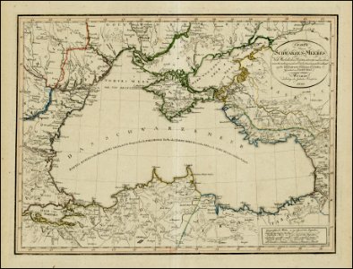
18th-century maps of the black sea
1800 maps of georgia
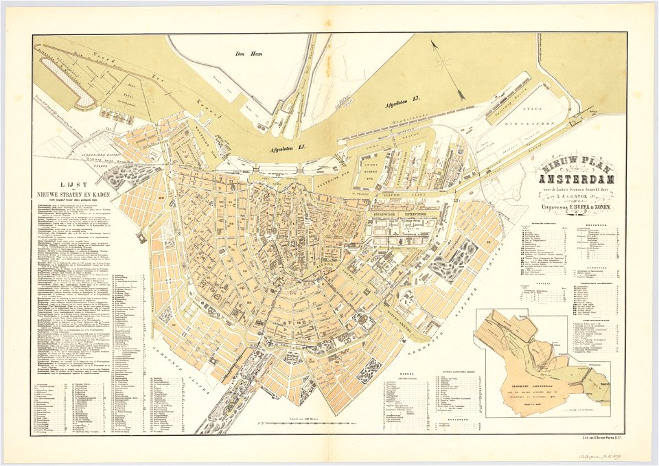
maps in the stadsarchief amsterdam
oosterdok
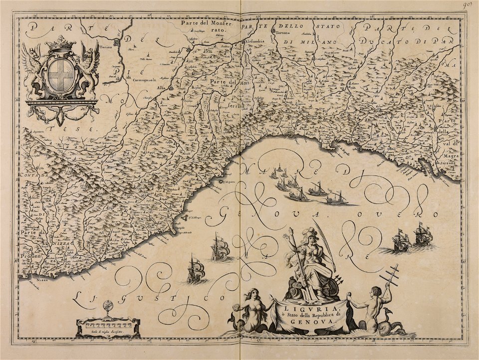
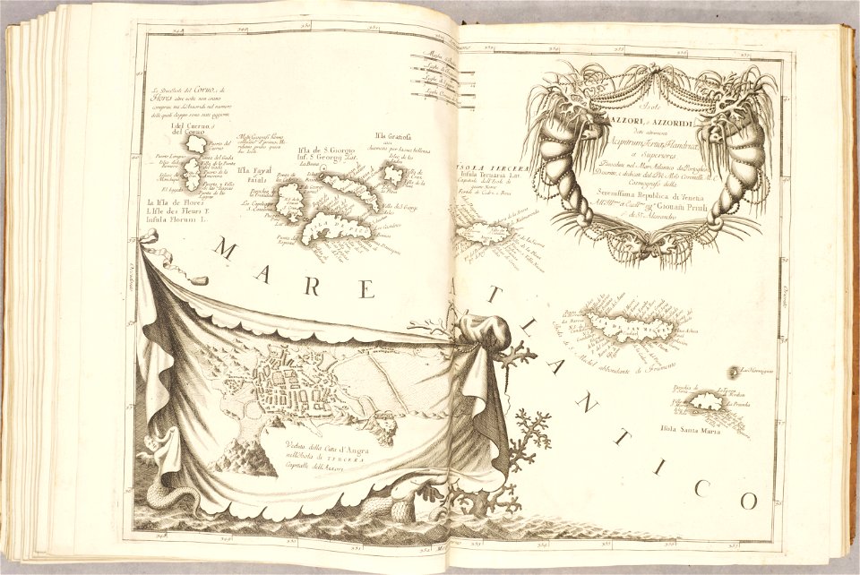
atlante veneto (raremaps.com) volume 2
old maps of the azores
atlante veneto (raremaps.com) volume 2
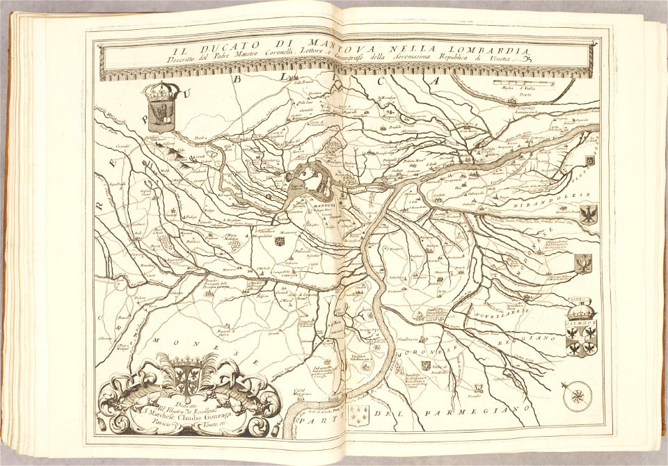
maps of the duchy of mantua
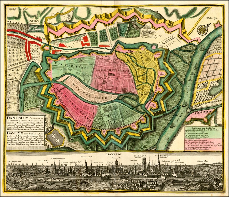
ports and harbours of the polish-lithuanian commonwealth
old maps of gdańsk
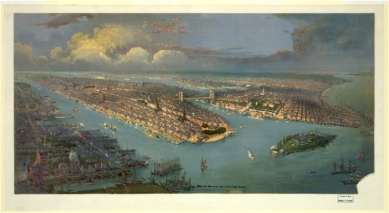
lithographs of new york city
chromolithograph
19th-century satirical maps
1870s maps of the world
new york
camden
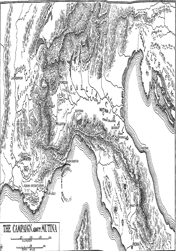
cicero and the fall of the roman republic
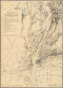
maps of battles
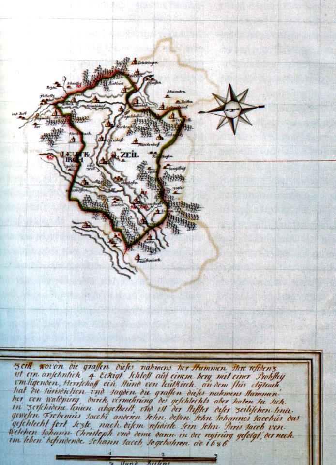
history of leutkirch im allgäu
schloss zeil
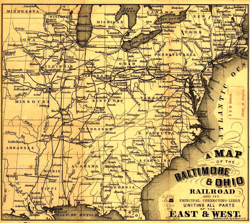
maps in the library of congress
a. hoen & co.
maps in the library of congress
a. hoen & co.
atlas van der hagen
1662 maps
atlas de wit 1698
frederick de wit
maps of antwerp city walls
frederick de wit
maps of gravelines city wall
frederick de wit
old maps of papua new guinea
maps of german new guinea
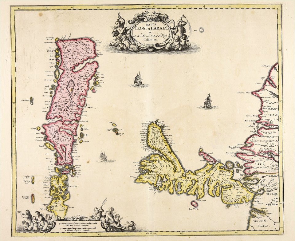
old maps of scandinavia
johannes ratelband
maps in the national library of australia
claes jansz. visscher (ii)
charts and maps of the royal museums greenwich
1682 maps
5501 - 5600 of 36,689
Next page
/ 367